
History in Maps
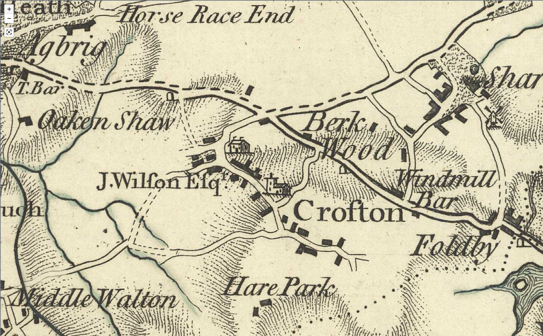
This is one of the first maps which shows Crofton in any detail. It was published in 1771 and was produced by an English mapmaker called Thomas Jefferys.
It shows a rural community of a similar structure to the village we see today. The village lies along the High Street/Harrison Road/Santingley Lane, but with far fewer buildings than are present today.
There would still have been a few buildings that we might recognise. The Lord of the Manor Pub was once a house and had been built 100 years earler. Bedford farmhouse was built at a similar time. The cottages next to the chemist on the High Street would also have been there. And of course All Saints Church would have been on the hill.
Some of the roads would also be familiar. Cock Lane, Slack Lane, Harrison Road and the High Street look to be in the same place. But Shay Lane and Lodge Lane don't have the same prominent marking as the others. Also note the road that goes from the centre of the village to Shay Lane. Only the top part still exists as a road (Hare Park Lane), but it still continues as a public footpath down the farm track.
The church is marked on the map, but also a picture of a house off Cock Lane. The clue to what this is the name written nearby. J.Wilfon Efq would be Joshua Wilson (1706-1778) and the building is Crofton Hall which he built in around 1750. You can find out more about this building in the Crofton In Pictures section of this site.
Windmill Bar is marked, possibly where Towers Lane is today. Several of the maps you will see have "Windmill" names in this area, but none identify a windmill specifically. It is known that Crofton Windmill was located near to the junction of Doncaster Road and Pontefract Road. This may be the building marked north of Doncaster Road. The building actually on the corner is most likely the Cock & Crown.